Translate
Skyway-West Hill Drainage Study for Capital Investment Project
This study reviewed the drainage basin within the Skyway - West Hill community. We evaluated the retention/detention facility needs to correct existing stormwater problems and prevent future ones. The study was called out in the 2016 Skyway-West Hill Action Plan (SWAP) (9.9 MB) and is now done.
The potential impacts from development lots will be assessed on water quality, flow control, and conveyance capacity. Any potential stormwater projects will be added to the existing project list in the area and develop a prioritized the list of actions.
The project activities include:
- Evaluate the Skyway - West Hill drainage area for potential stormwater project sites for flow control, water quality, habitat restoration and or fish passage. This includes issues such as erosion and sedimentation in the drainage area.
- Identify areas that were developed or redeveloped as a means to increase density but result in little or no flow or water quality control and evaluate surface water impacts due to the increasing impermeable areas.
- Connect with the community of Skyway - West Hill to identify any drainage areas of concern or potential areas of concern, not already identified by King County.
- Prepare an action plan, and identify criteria, for prioritizing potential projects for design and construction.
- Identify the cause of drainage flooding/erosion problems.
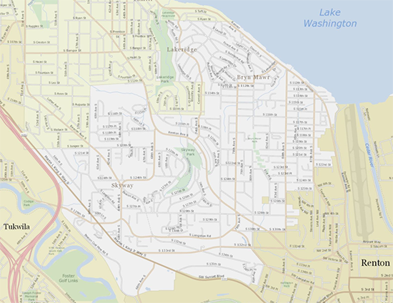
Location
The study area (in white color below) consists of the unincorporated area of King County referred to as West Hill, Skyway, Bryn Mawr, Earlington, Lakeridge, Campbell Hill, and Panorama View, south of Seattle.