
 Translate
King County Map Hub
Maps and map resources from all around King County government
Responses: M-F, 8am-5pm.
Most popular maps
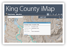
Use this application to view King County spatial information (GIS data and images) in a rich interactive map display. Customize your map display to show just the information you want to see at the best scale for your chosen purpose. iMap is your window to a wealth of geographic information from throughout King County on such topics as real property, natural resources, political boundaries, planning, and much more.
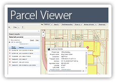
Find and select parcels by searching for addresses, parcel numbers, or street intersections, or just zoom in on the map and start selecting. For any parcel selected, you get easy-to-access links to the King County Assessor’s Report and the Districts and Development Conditions Report. You can also export data about single or multiple parcels.
See current road and travel alerts issued by King County DOT, Washington DOT, and several participating cities in the county. Also access traffic camera views, and during snowstorms see snowplow activity on roads maintained by King County.
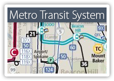
View the entire Metro Transit system in an interactive viewer. View and download PDF files of area system maps. See also this collection of downtown Seattle transit maps and, of course, Trip Planner.
New maps

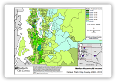
View demographic data mapped by census tract for 23 themes in five categories: Age and Sex, Foreign Born, Income, Race or Hispanic or Latino, and Languages Spoken.
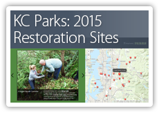
This interactive map photo tour shows all the sites on King County Parks lands that were planted with native trees and shrubs in 2015.
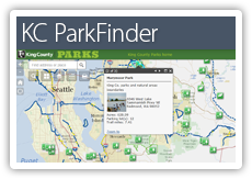
ParkFinder gives users quick and easy access to information about locations and facilities for the parks, natural areas, regional trails, and backcountry trails managed by King County Parks.
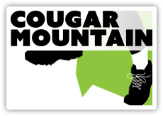
Look for the June 2016 revision to this map in the Backcountry Trails map series on the Recreation page in the Virtual Map Counter. It contains the new trailhead and trail designations that honor conservationist Harvey Manning's legacy of protecting Cougar Mountain. The entire Backcountry Trails map series comprises 18 maps that are available for viewing and downloading from the Virtual Map Counter as both standard and geospatial PDFs.
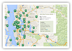
Use this interactive map on the Puget Sound Fresh website to find locations of, and information about, farmers markets in the Puget Sound area. You can filter by county and day of the week, and search by market name.
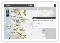
Use this interactive map on the Farmland Preservation Program website (scroll down the page) to view agricultural production districts and Farmland Preservation Program parcels.
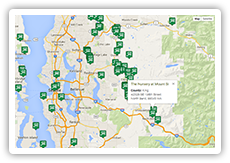
Use this interactive map on the Puget Sound Fresh website to find locations of farms in the Puget Sound area. A set of filters allows you to narrow your selection of farms based on a variety of criteria, such as farm products (e.g., dairy and eggs, livestock, grains, etc.) and certifications (e.g., certified organic).
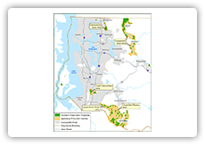
View a static, online map of agricultural production districts and farmland preservation properties on the Farmlands Protection Program website.
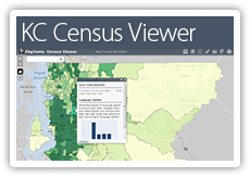
View demographic data mapped by census tract for 23 themes in five categories: Age and Sex, Foreign Born, Income, Race or Hispanic or Latino, and Languages Spoken.
See a table of community health indicators. Select an indicator to see the data displayed in an interactive map.
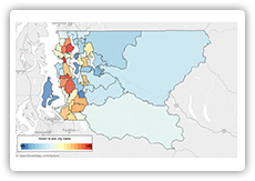
View a collection of maps on the King County Executive's Equity & Social Justice website that show the distribution of key demographics within King County: income, race/ethnicity, and languages spoken in King County. These maps are intended to be used by county staff for community engagement, program planning, and equity analyses. The maps are also meant to help other jurisdictions and members of the community better understand the county’s population.
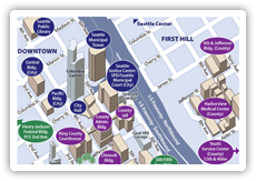
Go to this page to find information links for King County government office locations in downtown Seattle, including these maps:
- Clickable image map with links to standard and ADA print PDF files
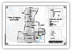
Go here to find an extensive listing of electoral district maps, from city precincts (such as the map depicted in the thumbnail above) to congressional districts. Most of the maps are PDF files, but you will also find links to several interactive maps, such as "Find my districts" and "King County Voter Turnout by Precinct."
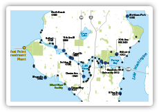
Combined sewer overflows (CSOs) are relief points in older sewer systems that carry sewage and stormwater in the same pipe. When heavy rains fill the pipes, CSOs release sewage and stormwater into rivers, lakes, or Puget Sound. This simple map depicts King County and City of Seattle CSO locations.
This interactive map photo tour shows all the sites on King County Parks lands that were planted with native trees and shrubs in 2015.
ParkFinder gives users quick and easy access to information about locations and facilities for the parks, natural areas, regional trails, and backcountry trails managed by King County Parks.
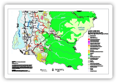
The 2016 King County Comprehensive Plan document, on the Office of the Executive website, includes numerous maps, such as the land use map depicted in the thumbnail above.
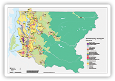
This map depicts a single contiguous, generalized data layer of zoning boundaries and designations for all areas of King County. View the map in the Virtual Map Counter.
Use this map to travel by bus, light rail, streetcar, bike and foot to visit interesting places and services in your neighborhood. Find out how close you are to parks, schools, libraries, local businesses, community services, and so much more! Leave your car at home and try a new way of getting around! At the map information page, you can view and download a two-page standard PDF file, or access geospatial PDF files of the north and south map segments for georeferenced use on mobile devices.