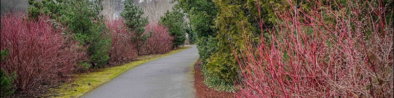
Green River Trail
Trail Description
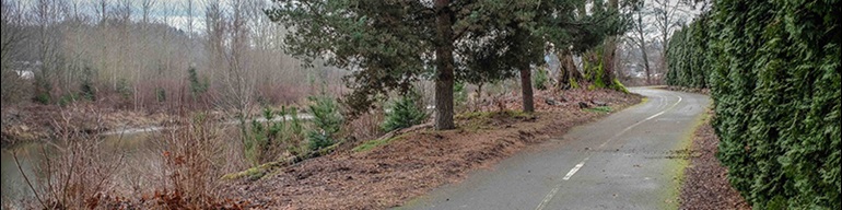
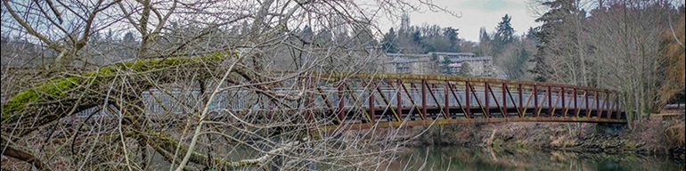
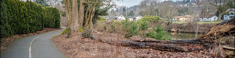
The Green River Trail winds more than 19 miles through industrial lands near the Duwamish Waterway in Tukwila to the broad Green River Valley. The trail provides excellent views and access to the Green River and surrounding river valley from Cecil Moses Park near Seattle’s south boundary to North Green River Park in south Kent near Auburn.
The trail links industrial lands to pastoral landscapes, parks, communities, and river views. Ideal for recreational journeys and nonmotorized commuting, the trail is highly popular with a variety of user groups. In the future the trail is slated to continue south through the City of Auburn and eventually to Flaming Geyser State Park at the Green River Gorge.
Want updated construction information?
Visit the Project Information by Segment section to view the latest in design, outreach, technical reports and more. We'll keep all our Green River Trail neighbors and stakeholders up to date as construction progresses.
New to the trail?
Visit the Trail History section to learn more about the trail's history, the collaboration that created the trail, and current management.
Be a part of the trails community!
The Green River Trail, much like all of our Regional Trails System trails, is a work in progress requiring constant management and upkeep. We always welcome constructive suggestion about trail maintenance, or safety from our users. Be sure to let us know if you see something on the trail that you think we can improve.
Questions? Comments?
www.parksfeedback.com
Trail History
A trail from Seattle to Kent along the Green and Duwamish Rivers – 
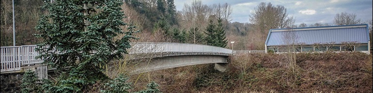
The Green River Trail is one of the longest contiguous regional trails in the Puget Sound Region with 19 paved miles from the south edge of Seattle to the city of Kent. Following the shore of the Green River and the Duwamish River the trail passes through Cecil Moses Park and Fort Dent before converging with the Interurban Trail, which it crosses again in the southern region at Foster Park.
An excellent commuting corridor for many of the workers in the local business parks, the trail crosses several bridges, goes under Interstate 5, and traverses an older neighborhood surrounded with commercial development, allowing travelers a varied landscape to enjoy.
Along the banks are Osprey nests, as well as a number of covered benches for bird watching.
Why did King County develop the Green River Trail? – The Green River Trail is part of a larger vision of mobility and access to all residents of King County. Not only does our Regional Trails System provide a connection between locations, it also connects people to healthy living, recreational opportunities, mental health, stress reduction and much, much more.
A trail for the community – By 2018, design of the extension project for the paved trail through South Park is expected to be approved, and in the year following construction is anticipated.
Design and construction of the extension will continue to adhere to the standards of other regional trails, and will provide a safe, multi-use regional trail for bicyclists, pedestrians, joggers, skaters, strollers, wheelchairs, and users of all ages and abilities.
Project Information:
Location: This project would extend the existing Green River Trail north from Cecil Moses Park in Tukwila, along W Marginal Place S to the Seattle City Limits near South Park, thus completing an important regional trail link.
Construction update: This project is in the preliminary design phase.
Recent Activity:
Trail Route Recommendation - King County is recommending a unique approach to routing an extension of the Green River Trail from Cecil Moses Park to Seattle's south border at Director Street. The County has conducted an Alternative Alignment Analysis for the Green River Trail North Extension that assessed several alternatives. The goal of the analysis was to determine a trail route that provides a safe and enjoyable trail for users, as the least impact to neighboring properties and the environment, and makes the best use of public funds. View one page project sheet. Leer los detalles del proyecto en español.
One-Way Alternative Recommended - The Green River Trail North Extension project is constrained by State Route 99, West Marginal Place S., private property and the Duwamish River. To build a pedestrian/bicycle facility to regional trail standards a unique design strategy is needed. The recommended alignment of the trail includes replacing the northbound drive lane of West Marginal Place S with a regional trail. Southbound vehicular traffic will still be accommodated. This approach includes a roundabout and a turnaround for vehicles at ends of the reconfigured road. The project will also build sections of new regional trail separated from roads by a vegetated planting strip. View a typical section of trail.
Several other alternatives were evaluated during the design process.
Current Timeline:
Milestone: | Date: |
|
|
Design:
- Alternative Alignment Analysis (May 2018)
Technical Reports: Future technical reports will be posted here for review.
Public Outreach:
Neighborhood Meeting Summaries:
- ECOSS Community Outreach Report (Dec 2019)
Project Manager: David Shaw