
 Translate
Fifteen Mile Creek Bridge No. 493C Replacement Project
Work scheduled to begin in summer 2025
Fifteen Mile Creek Bridge No. 493C connects Issaquah, Renton, and Maple Valley. The bridge is located between Tiger Mountain State Forest and Squak Mountain State Park Natural Area.
Status update
Winter 2024
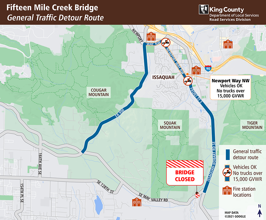
We plan to begin construction in summer 2025. SE May Valley Road will be closed for 10-12 weeks during for construction, and a temporary signed detour route will be in place.
For the most up-to-date status, check My Commute.
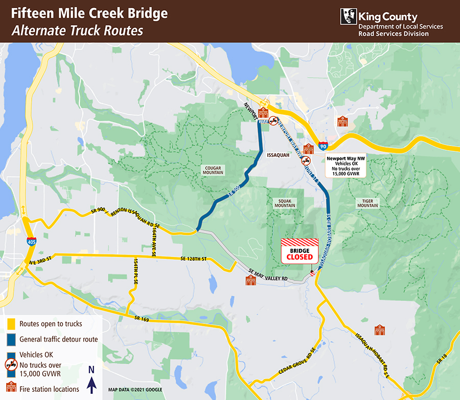
Project area map
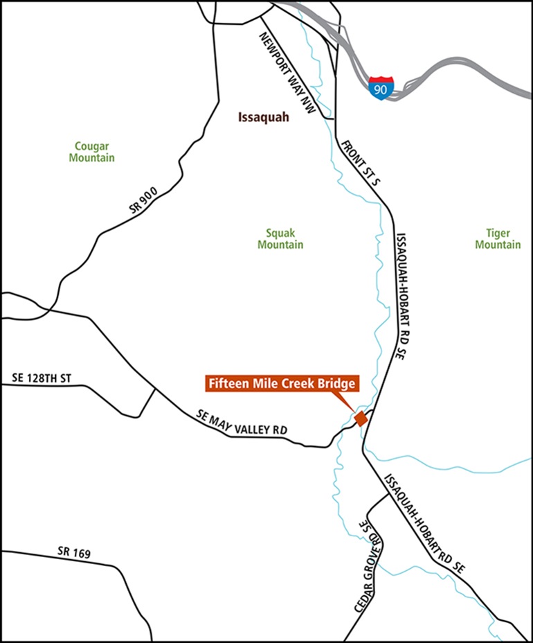
Map showing the Fifteen Mile Creek Bridge Replacement Project location on SE May Valley Road, just west of the intersection with Issaquah-Hobart Road SE. Larger view of the map (1MB)
Why King County is replacing this bridge
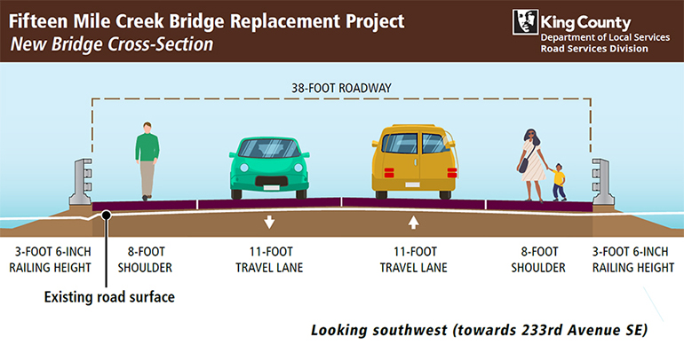
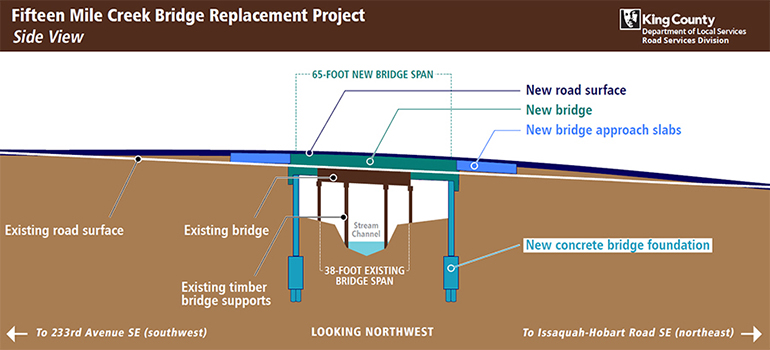
Larger view of the cross-section graphic (361KB)
We are replacing the Fifteen Mile Creek Bridge because it is past its useful life. We have repaired this bridge many times over the years, and now it is time to replace it. The new bridge will be designed to meet current national bridge standards. These standards include weight capacity, lane and shoulder widths, and environmental protection.
Improves safety by:
- Adding standard 8-foot shoulders on each side of the bridge for people walking, biking, and rolling.
- Increasing the height of the bridge railings by 14 inches, enhancing safety in the event of a collision.
- Raising the height of the bridge over the creek, providing more room for water to flow underneath during high-water events.
Environmental benefits:
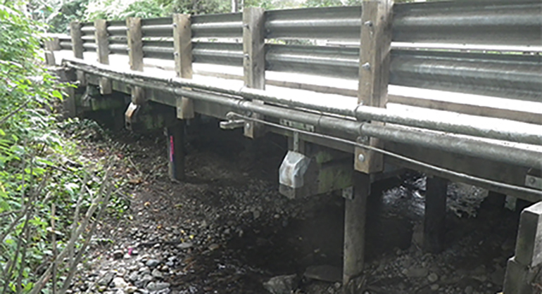
- The existing wooden bridge support piles are treated with creosote, which can be harmful to fish and the environment. This project removes the creosote support piles from the stream and replaces them with an out-of-water steel and concrete support system.
Maintains reliable routes for the community:
- The Fifteen Mile Creek Bridge replacement project is a long-term investment in route reliability, maintaining the connections between Issaquah, Maple Valley, and Renton. In 2009 and 2010, we also replaced two other bridges on the route connecting SR 900 and Issaquah-Hobart Road SE.
Getting through the construction zone
Work is scheduled to begin in summer 2025 to avoid the rainy season and minimize impacts on school bus service during the school year. We studied the option of building a temporary bridge during construction, but our studies showed that a temporary bridge would double construction time, be more expensive, and increase impacts on the environment, immediate neighbors, and the traveling public.
The existing bridge will be closed for 10-12 weeks during the summer months of construction, and a temporary signed detour route will be in place. The detour will add approximately ten (10) minutes to travel time.
Frequently asked questions
The new bridge will be 38 feet wide, with two 11-foot-wide travel lanes and two 8-foot-wide shoulders. The span (length) of the new bridge will be 65-feet-long. The longer span will allow the new concrete bridge footings to be located outside of the stream channel. The existing bridge is 27-feet-wide and 38-feet-long.
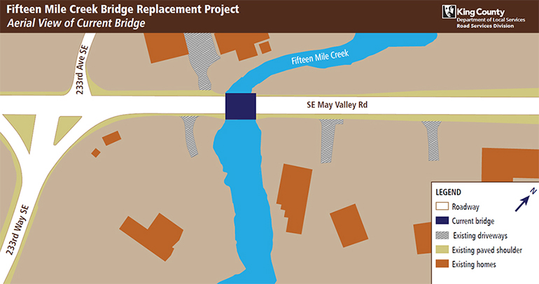
The new bridge will be built in the same location as the existing bridge. This project will not change anything about the location of the road or the bridge.
The new bridge will raise the bridge deck higher from the stream bed than the existing bridge. Raising the bridge deck creates more space for the water and floating debris to move freely under the bridge, even during high-water events. The higher bridge deck also will reduce the risk of flooding onto the roadway and provide a larger opening for floodwaters to pass through, which will reduce flood levels along the stream.
The City of Issaquah is planning to reinstall their flood monitoring device on the new bridge. The flood sensor is part of a citywide network that helps to indicate where water levels are high and predict flooding during heavy rain or storms.
Photos
The existing bridge does not have shoulders. The new bridge adds two 8-foot shoulders to the roadway.
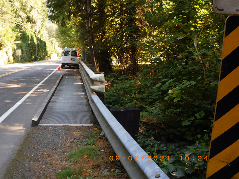
The existing bridge has a pedestrian sidewalk on one side of the bridge. The new bridge will have pedestrian pathways on both sides of the bridge.
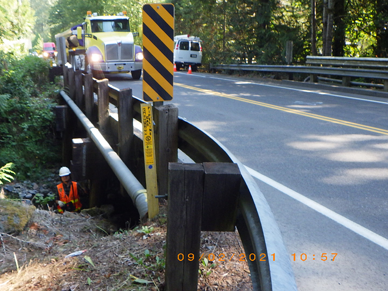
The wooden guardrail posts are aging and worn out. The project will replace the old wooden posts with a new, all-steel guardrail system.
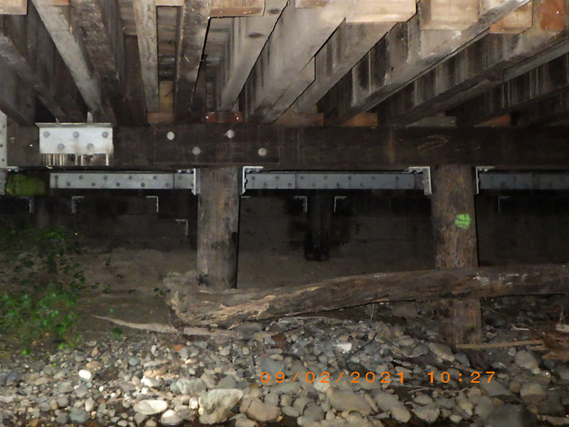
King County Road Services installed steel supports under the existing bridge to help strengthen the old, worn out timber cross beams.
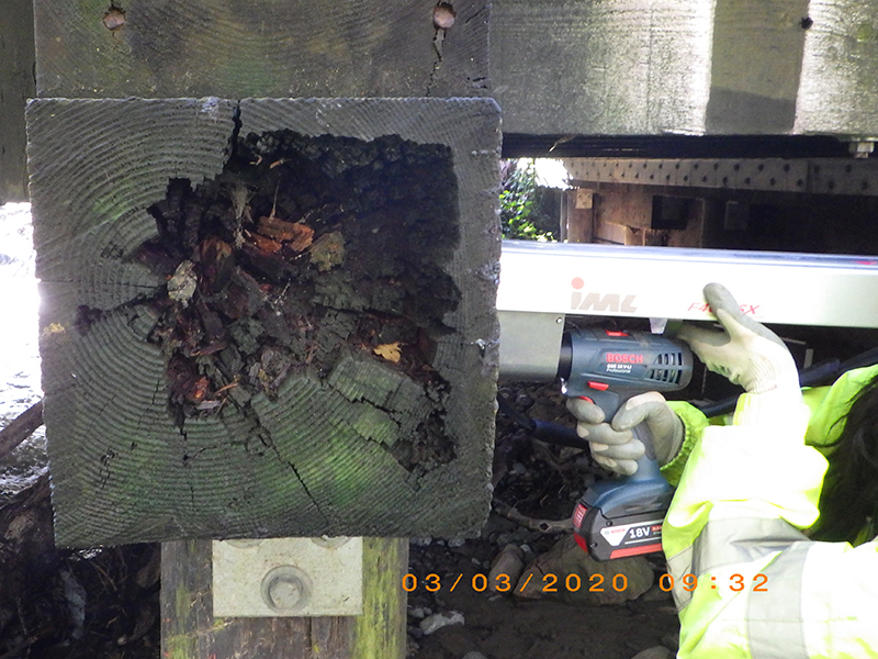
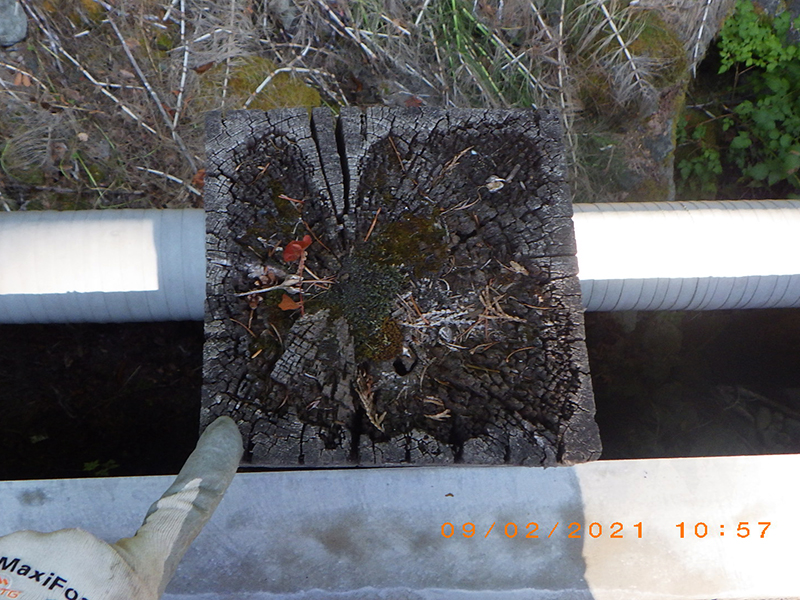
Some of the timber support beams on the existing bridge are worn out. The new bridge replaces the timber beams with concrete bridge foundations.
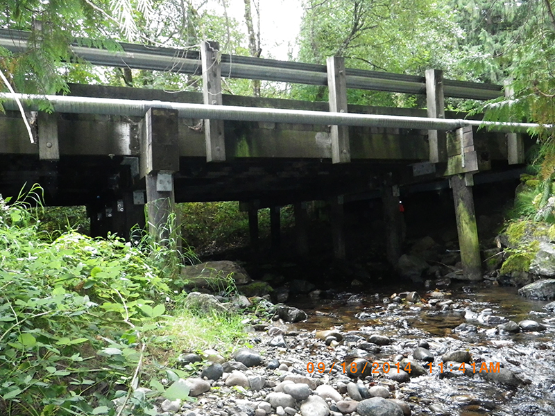
From this view of the bridge looking south, see the creosote-treated timber piles which are touching the water.