
 Translate
Historical Photographs
King County Archives holds over 25,000 photographic images in its collections: prints, negatives, slides, and digital images. These photos were created by county agencies as part of their program or functional responsibilities. The Archives organizes photographs by the agencies that created them or to the programs that they document.
You can view examples of our photo and A / V collections on Flickr, Vimeo, and Pinterest. Themes include parks, roads, art, bridges, County buildings, businesses, County citizens, daily activities of County employees, and the Kingdome.
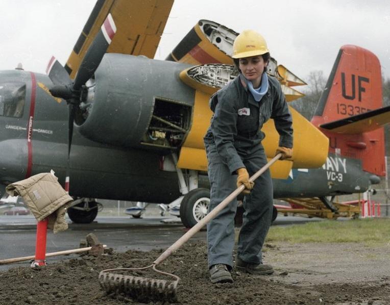
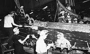
Series 400, Brittain Photographic Files, women at work
Through the Lens of P. T. Blum exhibit
Accession A07-056, Ahrens Photographic Files, box 10, image TS_11_A-0004
Series 400, Brittain Photographic Files, image 95-005-1022
Accession A10-051, Public Health Prevention, image 004
Executive Spellman Photograph Files, image 92.0.0252-1
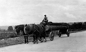
Series 400, Brittain Photographic Files, image 95-005-14
Series 400, Brittain Photographic Files, image 95-005-0179
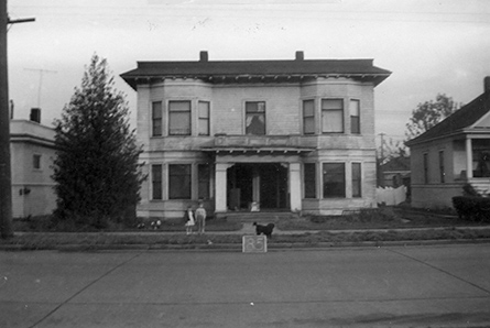
Real Property Record Cards, 1937-1972
The King County Assessor’s Real Property Record Cards capture information through time necessary to value land and buildings for the assessment and collection of property taxes. The cards were created as part of a survey funded by a contract between King County Assessor and the federal Works Progress Administration (WPA). The survey began in 1937 and was completed in 1940. The Real Property Record Cards were updated by the Assessor’s Office through 1972. The cards contain information on individual parcels of property, including legal descriptions, building types, building uses, number of rooms, construction details, and at least one photograph of each building on the parcel. If significant exterior changes were made to the buildings additional photographs were taken.
Puget Sound Regional Archives (PSRA) in Bellevue holds the original Real Property Record Cards. Contact them with the property's tax parcel number to order copies of the house photos and the information on the cards.
Series 288: Boeing Field files, 1928-1971
Deeds and other property records, appraisal reports, and bond issue files relating to the acquisition of property for the construction and development of the King County International Airport (Boeing Field). Bulk of the material documents the efforts to acquire land to expand the airport "clear zone" in the late 1950s, including a detailed appraisal report from 1955. This report contained individual photographs of over 100 homes and other sites in the Georgetown and Beacon Hill neighborhoods. A separate index to the photographs is available.
6320-22 1/2 13th Ave. South
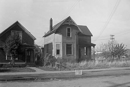
6305 15th Ave. South
King County Archives holds a number of significant photograph collections featured below. To learn more about the photos in our collection, please visit the Archives, contact us via email, or call (206) 263-2480.
Series 413: King County Executive John Spellman photographs, 1968 - 1969
Description
This collection consists of approximately 800 black and white and color images taken by various photographers. The images document Spellman's career in Washington State politics with an emphasis on King County recreational events and various groundbreaking, construction, and dedication events.
Specific subjects include the Kingdome; general construction, festivities, structures, and buildings related to King County; as well as meetings, ceremonies, portraits, work sites, fishing trips and sporting events. The images exist in a variety of formats including 35mm, 2x3, and 4x5 negatives, in addition to 8x10, 5x7, and 3x5 photographs and contact sheets.

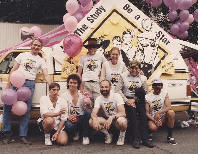
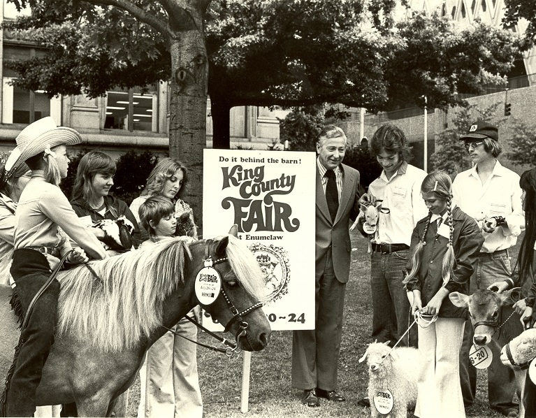
John Spellman at King County Fair, 1977, photo 92.0.0252
Historical Note
In May 1969, King County’s Home Rule Charter, a document that codifies the laws and regulations of King County as well as the structure of King County government, was adopted. The Charter established the elected office of King County Executive and defined the powers and duties of the office. These responsibilities have not changed since 1969.
The County Executive has supervisory power over all administrative offices and departments and is responsible for the county’s budget and comprehensive plans. The Executive also has the power to veto any county ordinance except as otherwise provided in the charter, and they are the legal signatory for all deeds, contracts and other instruments.
John Spellman served as the first King County Executive, holding office from 1969 until resigning to run for Washington State governor in 1980.
Series 473: King County Department of Stadium Administration records, 1972 - 2000
Description
This collection consists of annual reports, brochures, newsletters, press kits, and other publications and products created by the Public Information Office (PIO) to promote Kingdome events, activities, facilities, and services.
It also contains photographs, graphics, and other resources used by the PIO to develop its own promotional materials for the Department of Stadium Administration, as well as materials produced by outside organizations and collect by the PIO relating to the Kingdome, area tourism, and event booking and promotion.
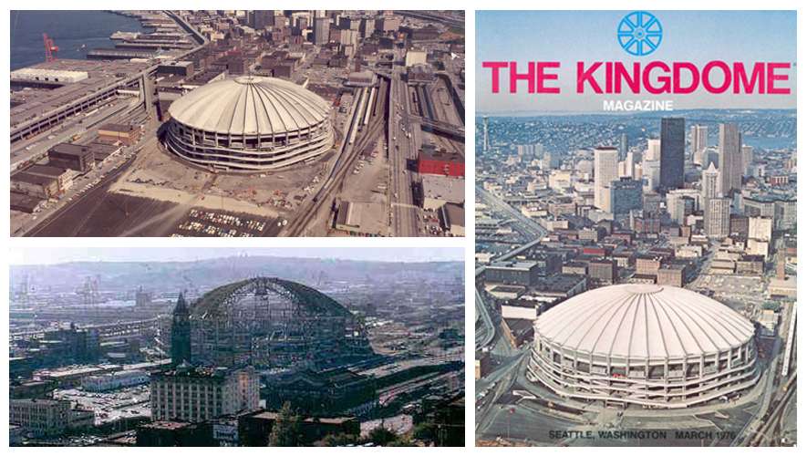
Left-hand column, bottom: Kingdome under construction, c. 1975, Box 3, File 5.
Historical Note
The Kingdome was a multi-purpose, covered stadium owned by King County and operated by the Department of Stadium Administration. By the 1950s, there was significant interest in constructing a domed sports stadium to attract new professional sports franchises to the county. In 1968, as a part of the Forward Thrust initiative, voters approved a $40 million bond for the stadium. On November 2, 1972, a groundbreaking ceremony was held at the 35.9-acre site located south of downtown Seattle. Originally estimated at a cost of $30 million, the final project totaled nearly $67 million. On March 27, 1976, the 9.1-acre concrete-domed stadium opened.
During the height of its operations, the Kingdome served as home to four major sports teams and hosted numerous trade and consumer shows, concerts, and other special events. Depending upon the configuration required for a specific event, the stadium could seat up to 70,000 people. It featured a sports museum, several meeting rooms with banquet facilities, and a parking lot that could be leased for special events. During its 24-year operation, approximately 3,000 major events were held at the Kingdome. Proceeds from rentals, parking, and a percentage of the revenue generated from advertising and concessions covered its operations. The King County Executive appointed a director to supervise the administration of the Department of Stadium Administration.
Although the Kingdome hosted a full calendar of events during its initial years of operation, by the mid-1980s, the number of events declined significantly following the demise of the Seattle Sounders and the relocation of the Seattle SuperSonics. The remaining regular sports tenants—the Seattle Mariners and the Seattle Seahawks—grew increasingly dissatisfied with the Kingdome and demanded changes to the facility. In 1990, the Department of Stadium Administration issued a master plan for the comprehensive redevelopment of the facility and its site. Not satisfied with these renovations, the owners of the Seattle Mariners insisted that a new stadium was the only way to keep the franchise in Seattle. In 1994, the Kingdome sat empty for nearly five months because the ceiling needed repair and a strike by Major League Baseball resulted in fewer games.
Prospective new ownership of the Seahawks also demanded a new facility, and in 1997, voters approved funding for a new football stadium to replace the Kingdome. A new baseball stadium and exhibition center was planned south of the Kingdome site, while a new football stadium was planned in place of the Kingdome. In early 2000, the Department of Stadium Administration ceased operation, and on March 26, 2000, the Kingdome was destroyed by implosion.
County Park System photographs, 1948-1998
Description
The King County Parks System photograph collection consists of images of county park and recreation facilities and programs from 1948 to 1998. These photos document the following: park sites and facilities; regional trails; swimming pools; recreation programs; and parks staff and administration. They also document major local or regional events sponsored by King County Parks such as Junior Olympics, Washington Games for Disabled Youth, Marymoor Heritage Festival, the Return to Newcastle, and the King County Fair.
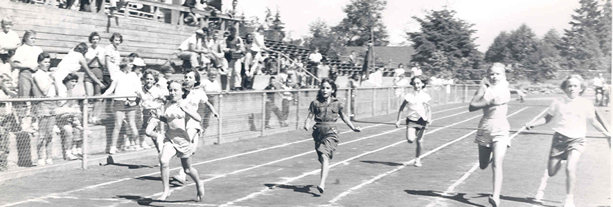
Highline Junior Olympics, 1953, photo 467-17-5
Historical Note
In 1948, the King County Parks System was established as an independent department. In 1972, it was designated as a subordinate unit within several county planning and resource departments. In 1997, the park programs resumed autonomy as the Parks and Recreation Department. Subsequently renamed the King County Park System, the agency encompassed three principal functional areas: administration; the Maintenance and Facilities Division; and the Recreation, Aquatics and Fairgrounds Division. An administrative section, the Program Development and Land Management Section (PDLM), experienced notable growth after 1997, reflecting the Park System's goal of establishing itself as a key steward of natural resource lands and wildlife habitat through the acquisition, preservation and management of forests, farmland, wetlands, and natural areas in King County. As of 2002, the Park System became a division within the newly reorganized Department of Natural Resources and Parks.
Content Description
The following topics are prominently represented within the collection: 1950s recreation programs for persons born female and disabled youth; facilities and programs developed in partnership with local school districts (1950s-1970s); facilities, particularly swimming pools, developed through the Forward Thrust capital improvement program (1968); recreation and leisure programs in the 1990s; and the development of regional parks and trails (1970s-1990s).
These materials exist in multiple formats including black-and-white prints and negatives, color prints and negatives, 35mm color slides, and glass slides (color and black-and-white). Aerial photographs, mostly circa 1969-1975, are present for many park sites and their adjacent neighborhoods.
Arrangement
Photo are arranged into seven subseries according to topic. Arrangement within each subseries is alphabetical by name of park, facility, event, or type of recreational program. Administrative photographs are arranged chronologically. Images have not generally been described individually.
Use Restrictions
Many images in this collection may be protected by copyright. Researchers are responsible for using in accordance with 17 U.S.C. and any other applicable statutes.
Separated Materials
The photograph files were originally located with Series 468: King County Parks' History Files but were separated due to their format.
Related Materials
Pre-1948 images of King County park facilities and structures are available in Series 400, Public Works Photograph Files.
Series 427: King County Design Commission project files, 1971-1979
Description
This series includes background materials for the report prepared by the Ecology Study Team on behalf of the Design Commission (Document Collection #3468). Includes administrative details of the project, scientific notes and data, a copy of the final report, as well as subsequent publications in response to the initial report. Also included are site plans and some photographs of Seahurst Park.
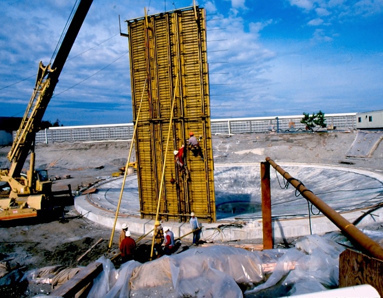
King County Department of Public Works photographs, 1900-2002
Historical Note
In May 1969, King County’s Home Rule Charter, a document that codifies the laws and regulations of King County as well as the structure of King County government, was adopted. The Charter established the organization and structure of King County government, and it outlined the originally executive departments, including Public Works, Utilities and Transportation.
The newly formed department was developed largely out of the former Road Engineering Department and retained functional responsibilities for road construction and maintenance, flood control and drainage maintenance, and oversight of the county's five sewer districts. In addition, Public Works assumed responsibility of waste disposal (through incorporation of the Department of Sanitary Operations), surface water management (through incorporation of the Hydraulics Department), management of the King County Airport (Boeing Field), and the county motor vehicle pool.
These functions were organized into four core divisions: Airport (1969-1993); Hydraulics (1969-1980, subsequently Surface Water Management (1981-1994); Roads (1969-1994, known as the Roads and Engineering Division circa 1988-1994); and Solid Waste (1969-1994). Two smaller program units that functioned quasi-divisionally under the department director were Fleet Administration (1982-1994), which absorbed and expanded upon the county's Equipment Rental and Revolving Fund program (1969-1981); and Sewer (1969-1980), subsequently Sewer Utility (1981-1986).
In 1980, Administrative Services, a support division, was established to oversee department’s personnel and facilities management functions and provided clerical support to the operational divisions. In 1987, Administrative Services absorbed Community Relations (established 1980) and the Public Information Officer (established 1985). It also managed the promotion and development of recycling programs within King County for the Commission for Marketing Recyclable Materials (1989-1994).
By 1982, the office was retitled Department of Public Works, and it was the largest single department in King County government. In 1986, the department was again restructured. The Sewer Utility division terminated in 1986 when King County relinquished management of its rural sewer districts and terminated the Sewer Utility Division. In 1993, the Airport Division transferred to the Department of Construction and Facilities Management.
In 1994-1996, King County eliminated the Department of Public Works as part of the merger with the Municipality of Metropolitan Seattle (METRO). Two new departments were formed—Department of Transportation and Department of Natural Resources—and each absorbed some of the divisions formerly part of Public Works. Fleet Administration and the Roads and Engineering Division became part of the Department of Transportation, while the Solid Waste, Surface Water Management, and the Commission for Marketing Recyclable Materials became part of the Department of Natural Resources.
Content Description
The Department of Public Works collection consists of multiple different record series, including several that contain mostly photographs. The contents of each photograph series are as follows:
Bob Brittain photographs
This series consists of images collected, maintained, and taken by Department of Public Works Photographer Bob Brittain in his official capacity working for the department from 1968 to 1997. The images range in topic from roads, bridges, accidents, construction, floods and flood damage to Boeing field, aircraft, aerial views, ecology, machinery, and department staff. The format of the materials includes 2x3 and 4x5 negatives, cellulose nitrate negatives, and prints, as well as glass lantern and color slides.
Levee Inspection records
This series consists of field inspection reports of levees along Snoqualmie, Raging, Tolt, Cedar and Green rivers. The materials contain project information, levee location map and description, technical evaluation, conclusions, and recommendations. Color field photographs, keyed to caption lists, are present in most files.
Solid Waste Division photographs
This is an artificial intentionally assembled series created from duplicate copies of Solid Waste Division report Solid Waste 1981-1986 Capital Improvement Program (1980; Archives document #1882). Record information, originally intended to support the division's request for capital improvement funds, includes photocopied site maps and color aerial photographs of transfer stations and landfills at Bow Lake, Cedar Falls, Cedar Hills, Duvall, Enumclaw, Hobart, Northshore and Vashon.
Community Relations and Communications photographs
This series consists of more than 600 black and white and color images used for various Department of Public Works publications—chiefly annual reports and promotional projects. The records were maintained by staff member Jan Klippert. The series contains many images of construction projects, equipment, and department employees, many of whom are identified by name. The series also contains a small number of early photographs of the Fall City concrete bridge; an album of 1979 winter storm damage in King County; and images from three scrapbooks documenting recreational activities at Si View Park (1950s-1970s). The image formats range from 35mm and 4x5 negatives to 8x10, 5x7, and 3x5 photographs and contact sheets.
Arrangement
The materials in this collection are organized into series by topic, format, and creator. The creator’s original organization in the Community Relations and Communications series has mostly been maintained.
These files contain 2x3 and 4x5 negatives, cellulose nitrate negatives, prints, glass lantern and color slides. Bob Brittain, photographer for the Department of Public Works from 1968-1997, collected, maintained, and used early images for his work. Later files contain Brittain's own work. Topics include: roads, bridges, accidents, construction, floods and flood damage, Boeing field, aircraft, aerial views, ecology, scenery, machinery, work methods and workers.Please contact the Archives with questions, or to schedule a viewing appointment.
Women building airplanes, photo 95-005-1752-N
Auburn, photo 95-005-0824-P
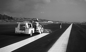
Boeing Field runway striping, 1972, photo 95-005-5374
Series 375: King County Road Engineer wharf files, 1906-1979
Description
These photographs, which are black and white prints, show many of the following images for each pier, ferry slip, or bunker: structure seen from various angles (shore and water, ground level, and elevated perspective); approaches (road or rail); ancillary structures (sheds, waiting rooms, retail businesses); adjacent terrain; adjacent residential and commercial structures; construction, maintenance, repairing or rebuilding of structure; and documentation of structure's deterioration.
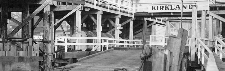
Kirkland Ferry Dock, 1936, photo 93.1.0118
Historical Note
In 1900, King County began purchasing, constructing, and maintaining public wharves, primarily as dock facilities for its ferry service on Puget Sound and Lakes Union and Washington. Starting approximately in 1924, administrative oversight of wharves became a function of the county engineer's office. The rise of land-based transportation following World War II forced the county to remove abandoned and unsafe wharves or convert others to recreational purposes.
Content Description
These files constitute a record of county wharf and ferry facilities, as well as rock bunkers and sea bulkheads, primarily between the years 1906-1959. The files, originally a part of the county's bridge files, contain correspondence, petitions, copies of Commissioner resolutions; inspection reports; plans and specifications, cost estimates, shop drawings, field sketches, maps, and plans; and photographs.
Alternative Format
Original negatives exist for many of the photographic prints.
Arrangement
King County originally ordered wharf files by unique wharf numbers; current arrangement somewhat reflects this.
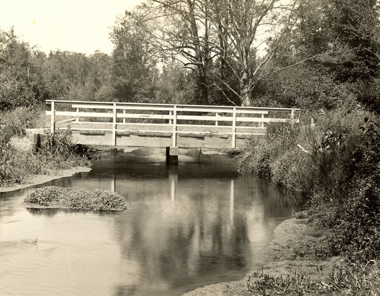
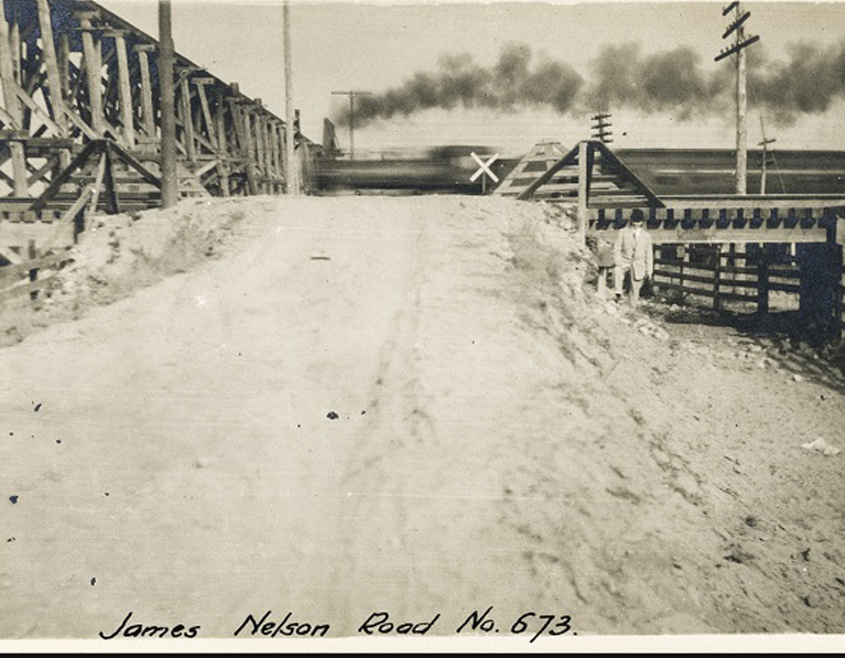
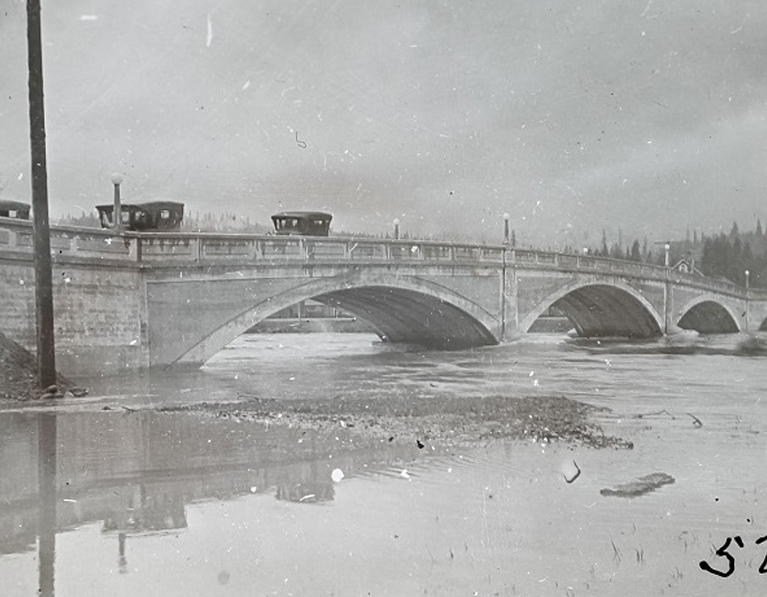
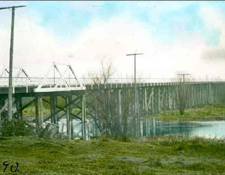
Series 474: King County Road Engineer bridge files, 1904 - 1988
Description
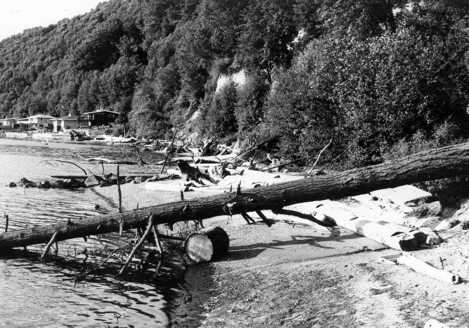
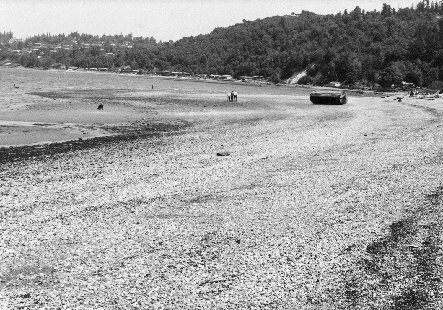
This series contains of photographs that were separated from Series 36: Road Engineer Bridge Files, 1901 - 1994. The photos document county activities in relation to bridges under the administration of several King County public works agencies (Engineer, Road Engineer, Department of Public Works). Most photographs date from three general time periods: 1910-1920, 1932-1936, and 1950-1988. Photographs from 1932-1936 were most often taken by bridge inspector Thomas P. Blum during summer inspection tours.
Historical Note
King County's public works agencies have been historically responsible for the siting, construction, inspection, maintenance, repair and replacement of highway bridges, overcrossings, and undercrossings within its jurisdiction. The county maintains a record of these activities for each bridge.
Bridges were assigned one or more identifying numbers by the county. The agency record for each bridge includes bridge number; bridge name if applicable; location (name of street or road, nearest city or town, section-township-range coordinates); and name of watercourse, railroad or highway spanned by the structure.
Arrangement
The photograph files are arranged numerically by the bridge number best representing the bulk of the photographs in a given folder. Within each folder, photographs are arranged in approximate chronological order. Negatives are present for many bridge images (particularly for the period 1910-1936) and are filed separately by bridge number.
A partial visual index has been created for this series, consisting of selected photocopied images. Selection criteria were: (1) all photographs prior to 1950; (2) images, 1950-1988, depicting the human and natural environment of bridge sites; and (3) images, 1950-1988, representative of county work activities at bridge sites.
Added information includes type of photographic materials present, date span of photographs, and limited keywords describing image content.
Additional Materials
Detailed or repetitive images of routine bridge inspections and of construction and repair work were generally excluded from the visual index but may be present in the folders themselves. The index also includes cross-references to many images of bridges found in Series 400: Public Works Project Photograph Files, 1898 - 1989.
View select photographs from this collection in the online exhibit The Bridges of King County: Through the Lens of T. P. Blum, 1931-1934.
Series 275: Seattle-King County Department of Public Health photographs, 1909-1970
This series includes photograph prints and negatives of Seattle and King County Health Departments' activities, including documentation of sanitation problems and public health staff at work. Major topics include housing conditions, garbage dumps, the Cedar River watershed, and public health programs. This series is comprised of about 2000 distinct images; many exist as both print and negative.
View select photographs from this collection in the online exhibit Second Look: Historic Images of the Seattle-King County Department of Public Health.
King County Archives holds the following two types of aerial photographs: photographs taken as part of a mapping project, usually for tax assessment purposes; and photographs taken incidentally as part of a county project or program.
Aerial Mapping Project
King County Archives holds photographic prints from aerial survey projects in 1936 and 1961 (partial). These photographs are organized by section-township-range coordinates. Each photograph shows one section of land. Many of the 1930s photographs can be accessed online through the Road Service Division's Map Vault.
Photos Taken Incidentally
Aerial photographs have been taken for projects such as:
- Land acquisition for park or trail development
- Farmland preservation
- Road or street construction or improvement
You may be able to find an aerial photograph of the object of your research if it was or is:
- Near a county structure, project, or facility
- In unincorporated King County
- On or near county-owned land
King County Archives holds aerial photographs for the following geographic locations and date ranges.
Boeing Field, 1931
Single aerial photograph of Boeing Field.
King County miscellaneous photograph collection, Series 49.
King County outside Seattle city limits, 1936-1937
1936 aerial photographic survey conducted as part of WPA Land Use Survey project.
King County Assessor's Office aerial survey, Series 1042, 1043, and 1532.
Indexed by section-township-range. Images are available online through the King County Roads Services Division Map Vault.
More information about this project is available in the Archives exhibit Films of King County Assessor Roy B. Misener, which features film footage documenting the survey project.
Cedar River, Green River, Kimball Creek, Patterson Creek, Raging River, Snoqualmie River, Andover Industrial and Commercial Site, circa 1938-1973
Mounted black-and-white prints, some of which are aerial views of sites of flooding and flood control facilities.
Department of Natural Resources and Parks: Water and Land Resources Division flooding and flood control project photographs, Series 1883.
Digital copies available. For additional aerial photos of flooding see also department's site Historical Flood Photos.
City of Shoreline, 15th Avenue NE and NE 150th Street, circa 1940-1949
Single aerial photograph (image # 275.27.23) of former naval hospital site, which in 1947 became the location of the Firland Sanitorium for treatment of tuberculosis patients.
King County Public Health photograph files, Series 275.
State Flood Control Zone District, 1947-1991
Aerial photographs are present in some permit files for individual properties.
Department of Transportation: Roads Services Division permit records, Series 630.
Sites throughout King County, 1950-1988
Photographs of department projects, include aerials.
Department of Transportation: Community Relations photograph files, Series 415.
Current and former landfill and transfer station sites throughout King County, 1950-2013
Aerial photos of County operated landfills and transfer stations. Series includes 8" x 8" photographic prints and oversized mounted prints.
Public Works, Solid Waste Division / Department of Natural Resources and Parks Solid Waste Division photograph files, Series 441.
South Park Bridge, Duwamish River area, 1955-1987
King County Road Engineer bridge files (photographs, Series 474, Box 15.
King County, 1958, 1959, 1960, 1964, 1968
Aerial photographs and maps used for residential appraisal. Indexed by flight path.
Department of Assessments / Residential Appraisal aerial photographs, Series 922.
King County, 1960-1989
Color aerial photographs.
Department of Transportation: Roads Services Division administrative working files, Series 629.
King County wastewater facilities, roads and streets, City of Seattle, circa 1960-2000
Photographs of METRO projects, property, and facilities; City of Seattle aerial photographs used in program promotion.
Department of Transportation photographs, Accession A07-056.
Unincorporated King County, circa 1960-2002
Many aerials of roads, rivers, county properties and structures. Videos also include aerial footage.
Department of Transportation: Road Services Division photograph and moving image files, Series 400.
Photos indexed by subject. Index available at the Archives. Some images available digitally.
Ranges 2E-6E, Townships 20-23, 25, 26, 1961
Aerial photostatic prints from Assessor survey.
King County Assessor's Office aerial photostat maps, Series 425.
Photos indexed by individual section. Index available at the Archives.
Ranges 3E-5E, circa 1961-1965
Diazotypes.
Department of Development and Environmental Services: Land Services Division: Series 1649.
Sammamish River Park, 1962-1966
Reproductions of aerial photographs included in applications for federal funding to purchase land for parks.
King County County Commissioners records, Series 1720.
Green River and Snoqualmie River areas, 1962-1968
Aerial films of search-and-rescue operations.
Department of Public Safety / Seattle-King County Office of Civil Defense films, Series 420.
Bellevue, Bothell, Burien, Duwamish area, Eastside area, Federal Way, Kent, north King County, Lake Sammamish, Lake Washington, Medina, Northgate area, Renton and the Cedar River, south Federal Way and Tukwila, Seattle neighborhoods, circa 1969-2000
Aerial photographs of County facilities and operations include surrounding areas.
Office of Information Resource Management: Printing and Graphic Arts photograph files, Series 1629.
Burien, Highline, Kenmore, Pacific Highway South, Shoreline, Soos Creek area, circa 1970-1979
Aerials documenting streets, highways, surrounding neighborhoods.
King County Public Works aerial photographs, Series 426.
Photos indexed by street. Index available at the Archives.
Unincorporated King County, 1970-1998
Series includes aerial images of property being considered by King County for parks acquisition for Forward Thrust.
King County Parks System photograph files, Series 467.
Photos indexed by subject. Index available at the Archives.
Marine, lake and stream shorelines, beaches and adjacent land areas, 1972-1975
Reproductions of aerial photographs as part of larger body of records.
Department of Community and Economic Development: Land Use Management shoreline inventories, Series 1634.
Downtown Seattle and south of downtown (SODO area), 1972-1999
Aerial photos of the Kingdome.
King County Stadium Administration photographs, Series 1608.
Photos indexed by subject. Index available at the Archives.
Green Valley (Yakima Valley) and Boulder Park (Douglas County) biosolids application sites, 1972-2008
Aerial recordings (VHS and Umatic video format).
Department of Natural Resources and Parks Wastewater Treatment Division: Biosolids Management Program records, Series 1819.
King County park sites, circa 1977-1990
Aerial photographs of County parks properties, black and white, printed on mylar.
Department of Natural Resources and Parks: Parks Division photograph files, Series 900.
Photos indexed by park name. Index available at the Archives.
Snoqualmie Valley, circa 1980-1989
Photostatic copies of aerial photographs.
King County Council subject files: Snoqualmie Valley Community Plan, Series 974.
King County wetlands, 1980-1990
Original aerial photographs marked with topographical contour lines and other data.
Department of Parks, Planning and Resources: Environmental Division project files, King County Wetlands Inventory, Series 1426.
Upper Snoqualmie River valley, Snoqualmie area, North Bend, 1981
Slide show from 1981 contains both ground and aerial photographs. A related sound cassette accompanies the photographs.
Department of Parks Planning and Resources Environmental Division: Photograph files: color slide presentations, SEPA section, Series 421.
Photos indexed by street. Index available at the Archives.
King County, 1984
Aerial photographs, compiled by the County Executive's Office, of property being considered for acquisition by the Farmland Preservation Program.
King County Executive Randy Revelle's subject files, Series 1407.
Puget Sound shoreline, Issaquah, and Cedar River area, 1986-1989
Black and white photographic prints from aerial survey as well as flight lines maps available.
Department of Natural Resources: Water and Land Resources Division aerial photographs, Series 1774.
Some images of Issaquah and Cedar River flights are available digitally.
Kent Highlands, 1987
Aerial photographs documenting County property acquisition in 1987.
Department of Executive Administration: Real Property Division miscellaneous program files, Series 411.
Additional Resources
The following aerial surveys are available through the Road Service Division's Map Vault.
- 1936 King County Assessor Aerial Survey
- 1942 U.S. Army Corps of Engineers Survey
- 1959 King County Assessor Aerial Survey
Aerial photographs of King County are also available from other King County departments, other public agencies, and private sources. To learn more, please visit the County's guide to natural resources reference maps. A few more resources are listed below:
- Department of Natural Resources DNR Photogrammetrist.
- The Seattle Municipal Archives photograph collection includes historical aerial photography of the City of Seattle and of City Light- and other utility-owned property.
TTY Relay 711
Phone / Email Hours
Monday to Friday, 9 am - 4 pm
Walk-in Lobby Hours
Tuesday and Wednesday, 10 am - 3 pm