Translate
Transportation
Virtual Map Counter
|
|
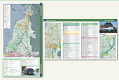
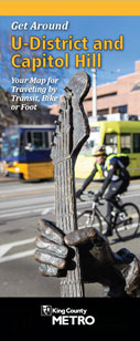
Get Around Your Neighborhood! Use this map to travel by bus, light rail, streetcar, bike and foot to visit interesting places and services in your neighborhood. Find out how close you are to parks, schools, libraries, local businesses, community services, and so much more! Leave your car at home and try a new way of getting around! Go here for complete information and access to PDF files of this two-sided map brochure, including geospatial PDFs—take the map with you on your mobile device, locate yourself in real time, record waypoints and tracks, and more. |
|
|
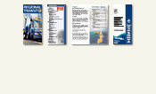
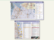
regional map sample fare-zone map sample facility table sample |
February 2014 Edition |
|
*This product appears here courtesy of Sound Transit. ©2014 Sound Transit, all rights reserved. |
|
|
Print Size See below for viewing/download options for all or part of the booklet. |
|
|
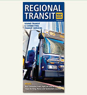
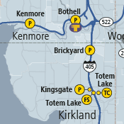
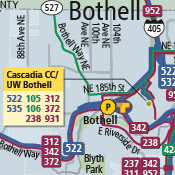
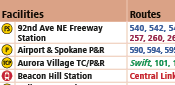
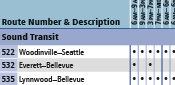
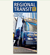
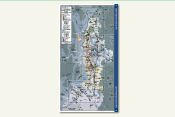
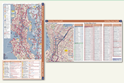
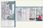
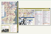
The “Regional Transit Map Book” is a 24-page collection of regional and local transit maps, service information, and provider contacts. It functions as both a high-level regional overview of public transportation options, and a convenient starting point for transit trip planning within the Sound Transit service area. Booklet features include a region-wide map that delineates the three-county Sound Transit District, and a separate larger-scale map for each of the five Sound Transit service subareas. The subarea maps depict all Sound Transit routes and the connecting local bus routes. Additional maps show even more detail for key urban transit locales. The maps are supplemented by tables of transit facilities, such as transit centers and park-and-ride lots, as well as the transit service options available at each facility. Bus route tables identify the routes depicted on the maps by number, description, and hours of service. Contact information for nearly twenty Puget Sound area transit service providers ensures ready access to the full range of regional travel options, including online trip planning services. The "Regional Transit Map Book" was conceived and developed by Sound Transit (external link) with cartographic and booklet design, layout, and production contracted to the King County GIS Center and executed by its Client Services team. Printed copies of the booklet are available at many transit locations throughout the service area. First edition: June 2006, second edition: February 2008, third edition: October 2010. |
|
|
Map Book Files |
|
|
|
Complete booklet: Regional Transit Map Book |
|
|
Partial booklet: cover and text-only pages |
|
|
Map: Central Puget Sound Service Area |
|
|
Maps & tables: Snohomish County |
|
|
Maps & tables: North King County / Seattle |
|
|
Maps & tables: East King County |
|
|
Maps & tables: South King County |
|
|
Maps & tables: Pierce County |