
 Translate
Taylor Mountain
About the park
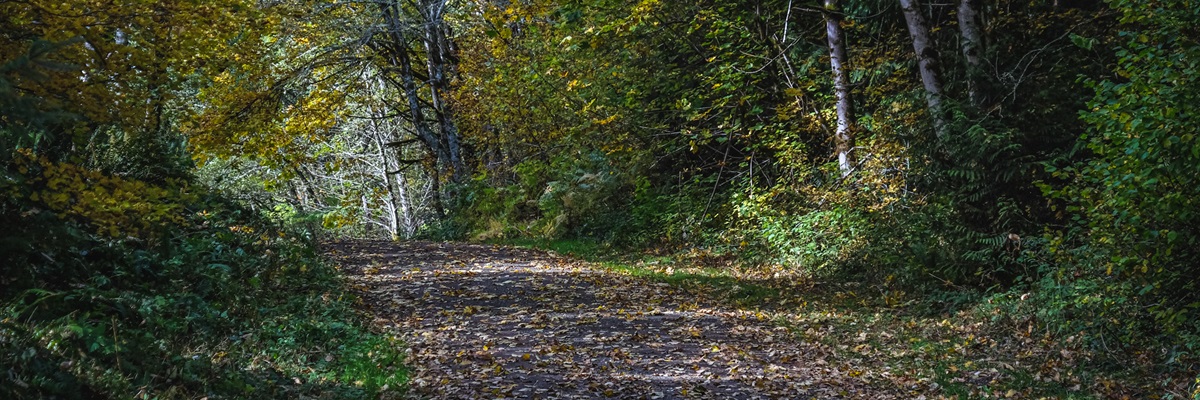
Connecting the Cedar River Watershed to the Tiger Mountain State Forest, the 1,924-acre Taylor Mountain Forest rewards visitors with views of Mount Rainier, forested wetlands, and meadows of wildflowers. Taylor Mountain Forest is also a Forest Stewardship Council® (license code FSC-C008225) certified working forest demonstrating how environmentally sound forest management protects and restores ecological systems while still allowing for recreational opportunities.
Taylor Mountain Forest has two major tributaries of Issaquah Creek: Holder Creek and Carey Creek, which provide more than five miles of spawning and rearing-habitat for salmon.
Throughout the forest, there are nearly thirty miles of trails and gravel roads used primarily by horseback riders but are also shared with hikers and mountain bike riders. Some trails are closed, during the rainy season, between October 15 and April 15 to protect the trails, prevent erosion, and reduce the amount of sediment entering the streams.
Park activities and facilities
Dog walking
Hiking
Horse riding
Mountain biking
Nature observation
Parking lot
ADA parking
Volunteer
Location
Southeast of Tiger Mountain, south of I-90 and east of SR 18, between Hobart and North Bend
Nearby Bus Stops
143 & DART Route 907 at Renton Maple Valley Rd and Cedar Grove Rd
Parking
The parking area can accommodate twenty-five trucks and horse trailers, plus twenty-five standard vehicles, along with handicap parking that includes one spot for a horse trailer and truck.
Trailhead
The main trailhead is at SE 188 St and 276 Ave SE
Current Work - Forest Health
In early 2024 forestry work occurred at Taylor Mountain to create a more diverse forest which in the long-term is more tolerant of warmer, drier weather brought on by climate change.
2024 Work Areas
- Area 1 is a 59-acre area located between Holder Knob Trail and Road A. This area has majority bigleaf maple with some cottonwood and red alder.
- Area 2 is a 39-acre area located between Carey Creek and Road K. This area also has a majority bigleaf maple with some cottonwood and red alder.
In Spring 2024 these areas will be replanted with mixed native conifers.
Several forestry projects have taken place at Taylor Mountain since 2005, most recently in the fall of 2022. All revenue from timber sales goes back into the restoration of the forest, such as invasive plant removal and tree planting.
Park history
Abridged from the 2003 Taylor Mountain Forest Stewardship Plan: Taylor Mountain Forest was likely used by the Snoqualmie, Duwamish, and Muckleshoot tribes for fishing, hunting and gathering, and as a major transportation link from Lake Sammamish to the Cedar River and across the Cascades.
Government Land Survey notes from 1891 and 1892 describe the area as “…covered with heavy fir, hemlock, cedar and spruce timber of good quality… A very dense undergrowth throughout…” Also noted were numerous brooks, creeks, and “branch springs." More than sixty settlers homesteaded in the vicinity at this time, many clustered around nearby Walsh Lake.
Logging was extensive throughout the area since the late 1880s. Logging was first accomplished with oxen, horses, and steam donkeys. Construction of a railroad allowed for more intensive harvest. Eventually fifteen miles of standard-gauge rail passed through the forests and to the top of Tiger Mountain. Several sawmills operated in the area. The Sherwood mill, was located on upper Carey Creek in the 1930s, probably milling cedar bolts cut from the large cedar stumps left standing in wet areas after the initial harvest. A 1930s stump house, created inside a hollow cedar stump with a sheet metal roof and equipped with pots, pans and dishes on the table, was discovered on the property in 1969. The artifacts were subsequently removed.
There were many forest fires in the vicinity in the early 1900s. In 1910, a big fire started in Kerriston and, spreading to Taylor, Walsh Lake, and Hobart, which consumed the railroad trestles at Taylor and Sherwood. The community at Walsh Lake was destroyed and two trains were marooned. Many of the large stumps on Taylor Mountain Forest bear evidence of the fires.
Taylor Mountain Forest continued to be harvested throughout the 1940s. An aerial photo from 1944 shows the Holder Creek drainage recently logged and much of the Carey Creek drainage logged or maintained as open grazing land. The most recent logging operations began in the 1970s, when approximately 60 percent of the site was clear-cut.