
 Translate
Rutledge Johnson Partial Levee Removal and Floodplain Restoration
Cedar River - Lake Washington Watershed
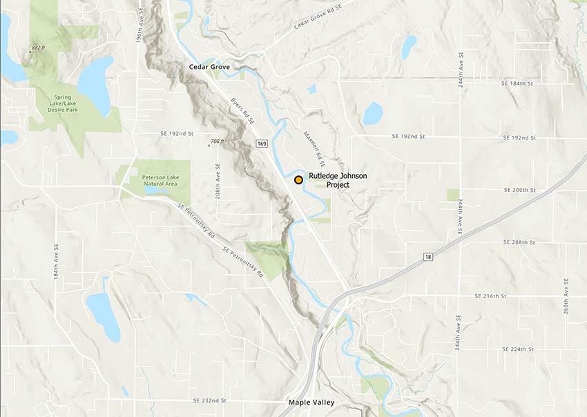
Project location
The Rutledge Johnson levee is located on public property on the south bank of the Cedar River in the Mouth of Taylor Creek reach between River Mile 13.1 and 13.5. The site is about 1.1 miles northwest of the State Route 18-Highway 169 interchange near Maple Valley.
Project goals
In reconnecting the floodplain, the project outcomes will be to improve salmon habitat, specifically:
- improve the quality, quantity and sustainability of in-stream and off-channel habitat for Chinook, steelhead and other Puget Sound salmonids that rely on the Cedar River for spawning and rearing through restoration;
- maintain or reduce current levels of flood and erosion risk to people, property and infrastructure; and
- allow public access to the site for safe, passive recreation considering the changing nature of the river and its banks.
Project benefits
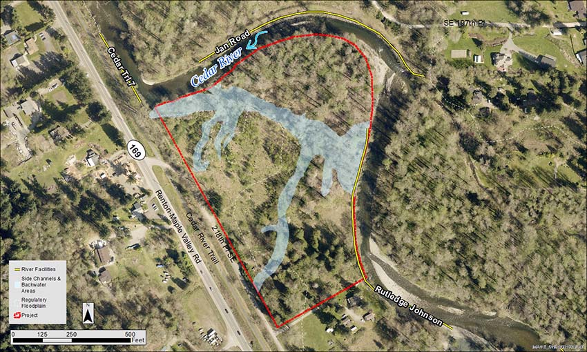
This project emphasizes floodplain reconnection and improved access to critical off-channel habitat through removal of an obsolete section of the Rutledge Johnson levee, and is prioritized in the WRIA 8 Chinook Salmon Conservation Plan. The loss of critical habitat features due to bank armoring and disconnection of the river channel from side-channels and floodplains has been identified as a primary factor limiting Chinook salmon productivity in the Cedar River.
Key project outcomes include the following:
- Removal of up to 600 feet of the Rutledge Johnson levee.
- Access to 16 acres of newly available floodplain on publicly owned open space.
- Perennial flow-through connections to an existing side channel and wetlands adjacent to the Cedar River.
- Renewed access to future sources of wood recruitment to improve habitat in the reach.
- Maintain or reduce current levels of flood and erosion risk to people, property and infrastructure.
- Restored, forested buffers along the river and side channels with native riparian trees and shrubs.
Removing an obsolete section of the Rutledge Johnson levee will reconnect valuable habitat for salmonids and support healthy aquatic habitat. Increased floodplain capacity will provide greater flood storage and help to dissipate floodwater energy during floods. King County has been replacing invasive vegetation with native plants at the site since 2015, and will continue through project completion.
Project site map
Project updates
Sign-up to receive project updates through King County’s Govdelivery.
Project timeline
| Benchmark | Date |
|---|---|
| Planning and preliminary design | 2019-2022 |
| Final design and permitting | 2023-2024 |
| Construction | Summer 2024 |
| Monitoring and maintenance | 2024-2034 |
Project documents
Project-related documents will be posted here as they are completed.
Project design funding
- King County Water and Land Resources Division
- Washington State Salmon Recovery Funding Board
- King County Flood Control District Cooperative Watershed Management Program
- Open Space Rivers Corridors Award
For more information about the Rutledge Johnson Partial Levee Removal and Floodplain Restoration Project, please contact Deborah Pessoa, Project Manager, King County Ecological Restoration and Engineering Services.